

Let’s start off with noting that the threats are extremely low with the upcoming cold front. The Storm Predicition Center has a marginal risk, level 1 of 5 in place south of I70 Wednesday and the entire Valley under the same for Thursday.

This means an isolated severe storm is possible, but not likely. The main threat is strong damaging winds. Gusts may reach 60 mph with a stray afternoon storm.
[DOWNLOAD: Free Storm Center 7 Weather app for alerts as news breaks]
Rain chances are scattered. This won’t be a washout. Heaviest and stronger storms will arrive after 2 PM Wednesday and linger into the evening.
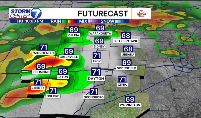
Thursday’s rainfall will be light in the morning, but a line of stronger storms will arrive late evening and especially into the overnight hours. Thursday will have the greatest chance for stronger storms. Even then, the threat is low.
[WATCH Storm Center 7 Weather on the following devices]
Rainfall totals will amount to rough a half inch to and inch through Friday. Isolated higher amounts are possible, in upwards of 2 inches. Any leftover rain will push out of the Miami Valley later Friday.
©2026 Cox Media Group